Basic Geography
 An advantage (one I consciously cultivated) about having a quasi-historical Mediterranean setting is being able to use, well, a real map of the Mediterranean. I love maps, but my cartography skills are mediocre at best. Drawing maps is also fun, but time intensive. Using real world geography and maps is helpful in this way, saving me time and allowing me to show future players better quality images than I could ever feasibly produce. (Don't think, however, I didn't think about using the back of a paper grocery bag to draw a map, a la middle-school days).
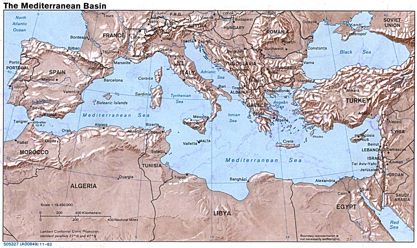
Looking at this map (a very cool one from the 16th Century), I am flooded with questions and ideas:
- The sea is bottlenecked at both ends -- Gibraltar on the west and the Bosporus to the east. One leads out to the ocean, the other to a large inland sea. Both are highly strategic. Who controls these chokepoints? What do they do? Are there fortresses? High tariffs? Gigantic gates?
- A narrow strip of land separates the Med from the Red Sea, at the Suez. Is there a canal? Who controls it? Are there ports on both sides? If there isn't a canal, is there a well-established trading road?
- There are lots of islands, from large ones (Sicily, Sardenia) to tiny ones, scattered about like pebbles. What's on them? Is this where the pirates hang out? Is there a pirate city?
- What does one need to to to get from the ports surrounding the sea into the interior? There's desert to the south, forests to the north. How easy is it to get there, or to get across land at all? What are the hazards?
These are just a few. They are all based on existing geography, topography, and climate. There's plenty to think about, even assuming I don't make any major changes. I am considering making a significant one -- something may explode. . .
It's fun to look at real maps and see something... different. I did something similar with my Greenstone setting (based on New Zealand).
ReplyDeleteOne way to look at a map and get a completely new perspective on things is to turn it upside down and see what stands out at a different angle. we are so used to looking at maps from a N-S perspective that when flipped it opens up lots of new possibilities. And from a universal point of view, there is nothing that says that N=up and S=down.
ReplyDelete@RisusMonkey -- your Greenstone idea (using Google Maps) is part of how I ended up here!
ReplyDelete@Cthulhu's Librarian -- excellent idea, although I'll likely still use the Med. map as is (at least in orientation). Otherwise, I'd just confuse myself.
Oh, I wasn't saying you should use the map in the game upside down, but that you might get some ideas if you look at it from a different view, to free the geographic features from preconceived ideas. Just flip the map back around and apply those ideas to the standard view to use in game.
ReplyDelete@CL I did that exact thing on my last incarnation of sylnae. I took a map of Southeast Asia, turned it sideways, erased a few islands, then spiced it up a little. Worked perfectly.
ReplyDelete